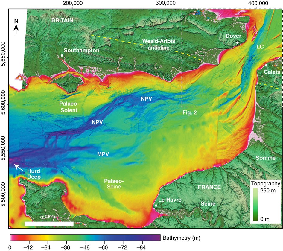
Figure 1: Sonar bathymetry of the eastern English Channel shelf.
From: Two-stage opening of the Dover Strait and the origin of island Britain

Map showing bathymetry of the eastern English Channel gridded at 30 m cell size. The location of the study area in Fig. 2 is indicated. LC, Lobourg Channel; MPV, Median Palaeovalley; NPV, Northern Palaeovalley. An analysis of the downstream morphology is given in ref. 7. See Methods for details of offshore bathymetry data. Onshore elevation is from SRTM51. Yellow dashed line indicates the axial trace of the Weald–Artois anticline.
