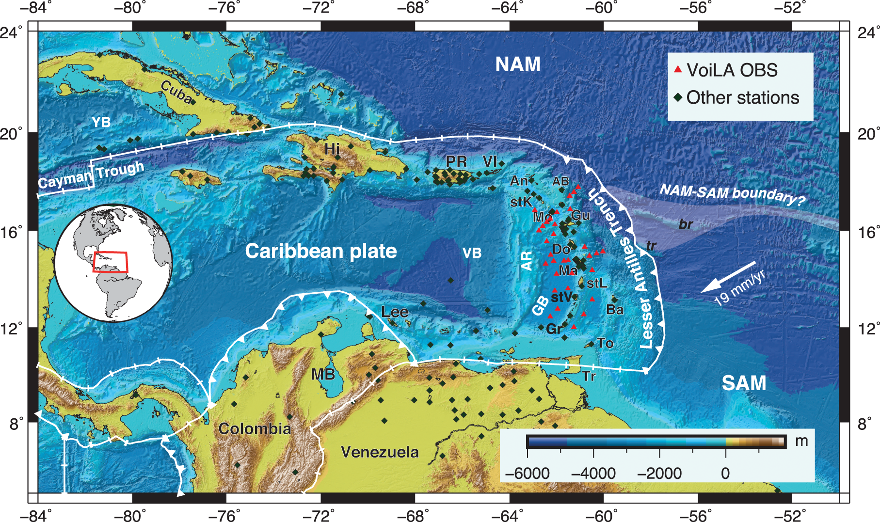
Fig. 1: Current tectonic map of the Caribbean.
From: Subduction history of the Caribbean from upper-mantle seismic imaging and plate reconstruction

Plate boundaries from Bird66. Uncertainty in the position of the NAM–SAM plate boundary is indicated by white shading. Plate motion vector is for Atlantic seafloor relative to the Caribbean plate26. Regional seismic networks used for this study include our VoiLA experiment with ocean-bottom seismometers (red triangles) and additional land stations (dark-green diamonds) from which data were added to the global EHB catalogue53. An Anguila, AB Antigua and Barbuda (Limestone Caribbees), AR Aves Ridge, Ba Barbados, br Barracuda Ridge, Do Dominica, GB Grenada Basin, Gr Grenada, Gu Guadeloupe, Hi Hispaniola, Lee Leeward Antilles, Ma Martinique, MB Maracaibo Basin, Mo Montserrat, NAM North American plate, PR Puerto Rico, SAM South American plate, stK St Kitts and Nevis, stL St Lucia, stV St. Vincent, To Tobago, Tr Trinidad, tr Tiburon Ridge, VB Venezuela Basin, VI Virgin Islands, YB Yucatán Basin.
