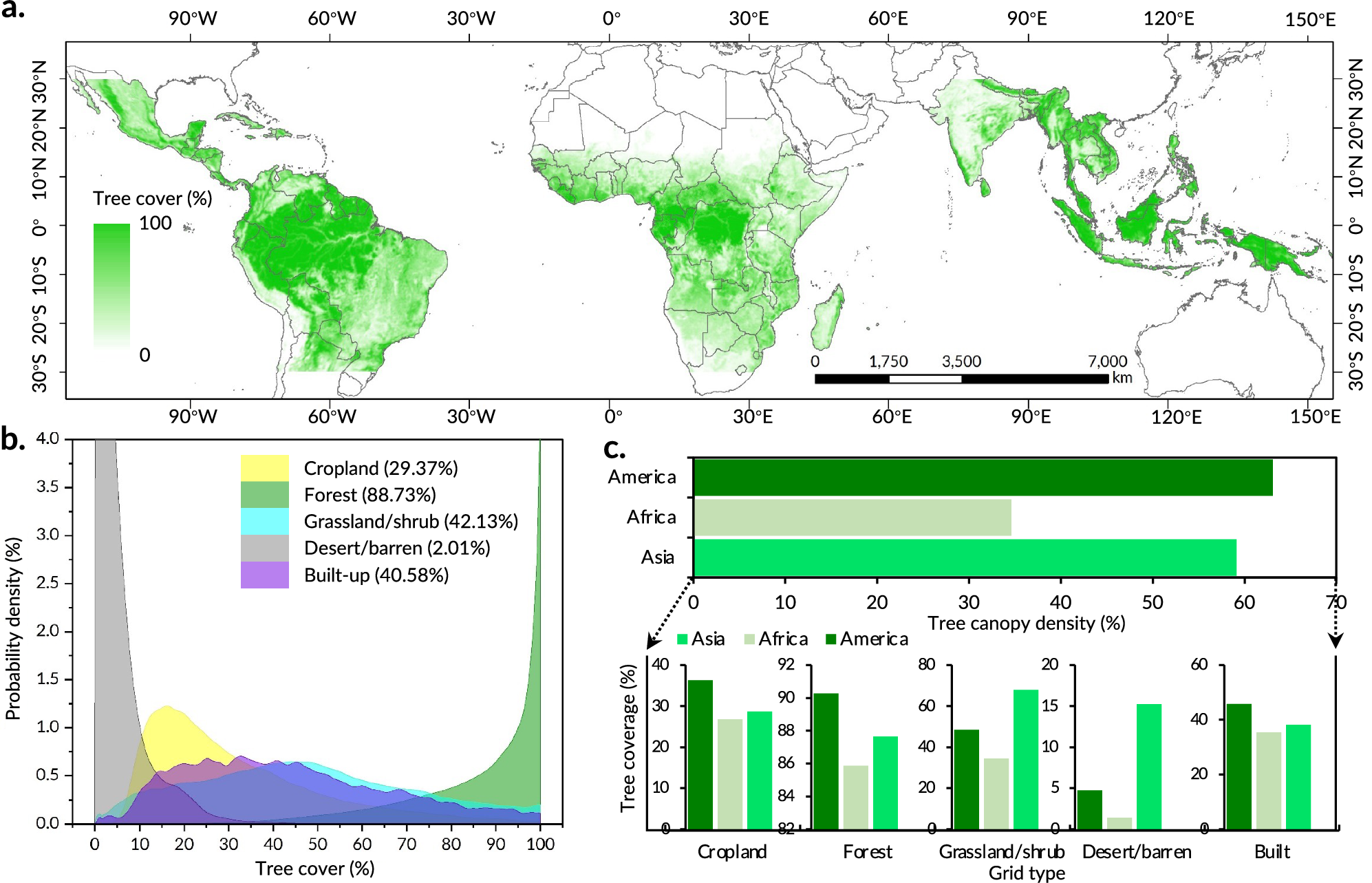
Fig. 1: pan-tropical tree cover.
From: Mapping previously undetected trees reveals overlooked changes in pan-tropical tree cover

a and b represent the spatial distribution of pan-tropical tree cover and that in different grid types, respectively. c is the proportion of pan-tropical tree cover in different grid types in different regions. Data for this figure are available at Zenodo (https://doi.org/10.5281/zenodo.14892757).
