
Fig. 3: A selection of seep sites discovered in the McMurdo Sound region to date, with year of emergence indicated.
From: Antarctic seep emergence and discovery in the shallow coastal environment
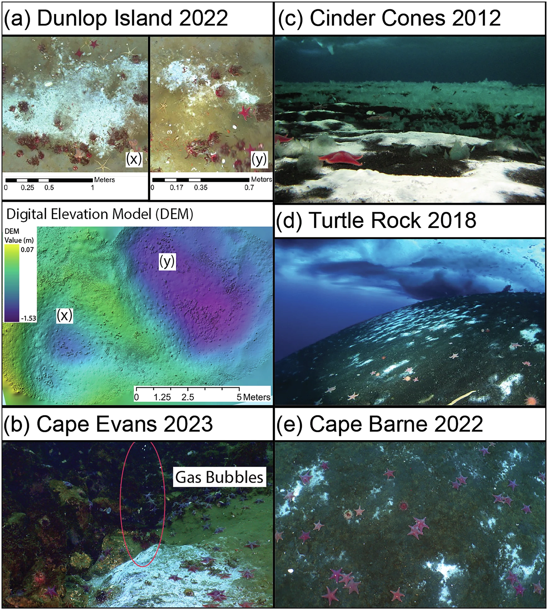
a Microbial mats (x and y) on the seafloor identified near Dunlop Island (30 m water depth), with a Digital Elevation Model (DEM) showing depressions in the seafloor, apparent seafloor pockmarks, associated with the seep site - the locations of the microbial mats are indicated in the DEM with x and y. b A seep site at Cape Evans (23 m water depth), showing the seafloor with microbial mats and gas bubbles escaping into the water column (see Supplemental Video 1). c–e Images of microbial mats correlated to seafloor seepage at Cinder Cones, Turtle Rock (image taken by Rob Robbins), and Cape Barne.
