
Fig. 3: Details of sea-floor ribs on high-resolution AUV sidescan and multibeam data.
From: Rapid retreat of Thwaites Glacier in the pre-satellite era
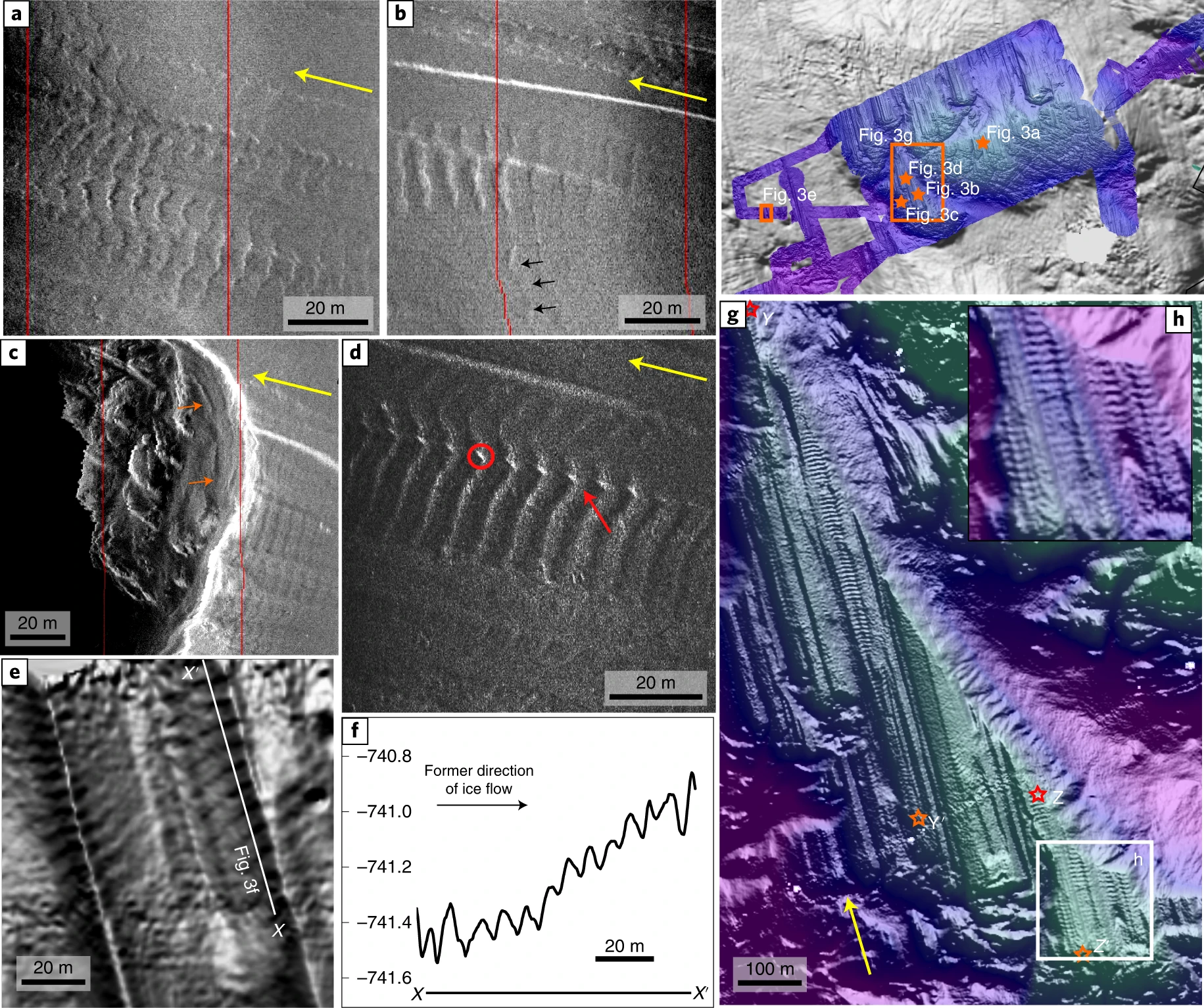
a–d, Examples of high-frequency sidescan imagery illustrating the back-stepping conformity of ridge shape (a), non-alignment of ribs to underlying lineations (b), rib formation on terraces (c) and the ‘beading’ (red circle) and overprinting (red arrow) of existing subglacial features (d). e, Multibeam hillshade showing fine-scale landforms, <20 cm high, crossing lineation ridges and grooves. f, Corresponding profile X–X′, demonstrating the subtle geometries of some of the landforms (5–20 cm) and their surprising depth (>740 m). g,h, Multibeam swath bathymetry covering the longest series of ribs (profile Y–Y′ and Z–Z′ combined; stars mark start and end of profile sections). Inset shows close-up example of lateral continuity in the southern portion of the ribs. Black arrows in ‘b’ mark lateral continuation of one oblique ridge. Yellow arrows in each image show ice flow direction inferred from lineations.
