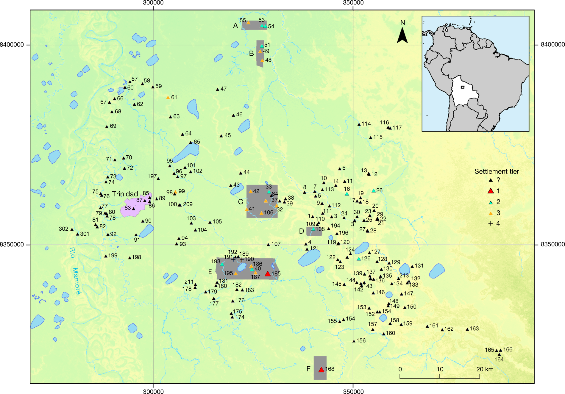
Fig. 1: Map of the southeastern Llanos de Mojos.
From: Lidar reveals pre-Hispanic low-density urbanism in the Bolivian Amazon

Lidar coverage is marked by the grey areas (A–F). Black triangles represent settlement sites of the Casarabe culture that have platform mound architecture. The topographical layer is based on TanDEM-X DEM 12-m data.
