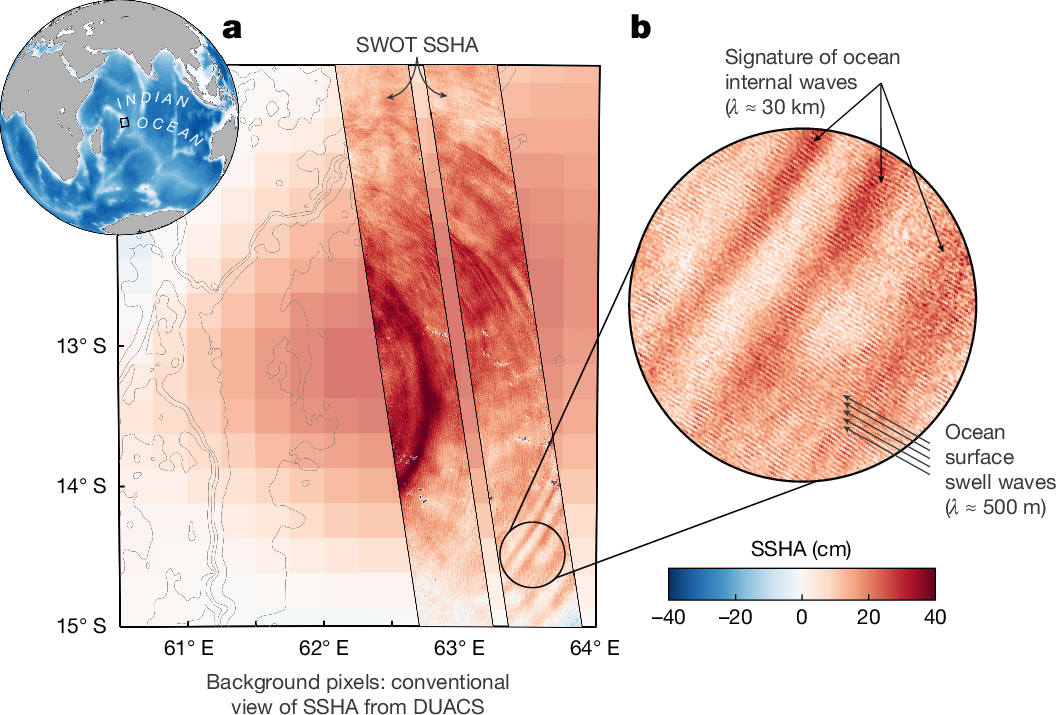
Fig. 1: The advance of SWOT beyond conventional altimetry.
From: Wide-swath satellite altimetry unveils global submesoscale ocean dynamics

An example in the east Indian Ocean at the Mascarene Plateau on 8 May 2023. a, Globe inset shows ocean bathymetry from ETOPO1 data; the black box denotes the Mascarene Plateau region. The main panel shows a background map of DUACS SSHA generated by AVISO+ using conventional altimetry data, superimposed with a swath from SWOT L2 unsmoothed SSHA. DUACS provides mapped spatial coverage at low resolution (about 150 km in space and about 15 days in time). SWOT provides a swath, limited in space, at high resolution (about 1 km in space and near-instantaneous in time). b, Zoom-in of the swath reveals the very high resolution of SWOT, beyond conventional altimetry: nonlinear internal waves and surface swell waves are captured in the SWOT SSHA measurements.
