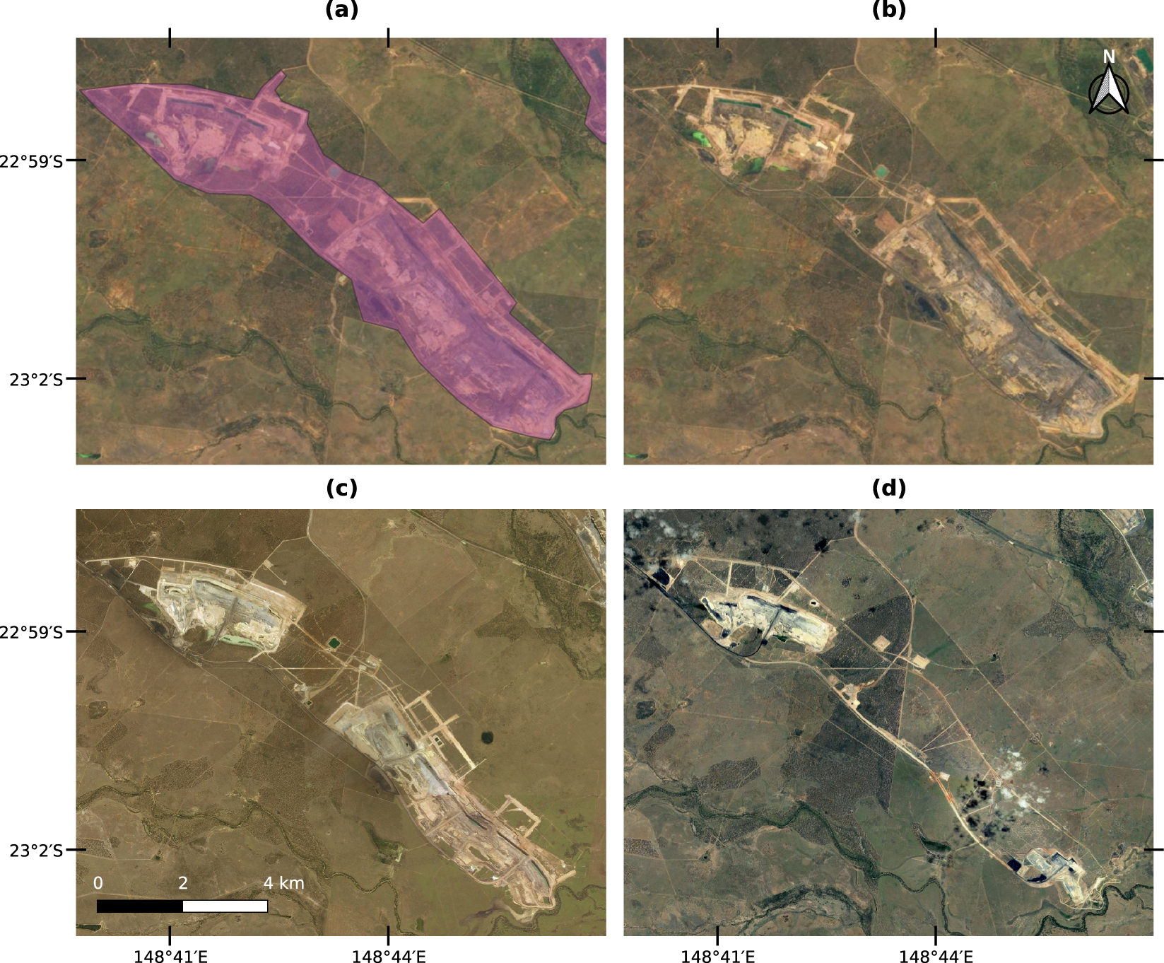
Fig. 1

An example polygon delineated over a coal mine in Mackenzie River, Queensland, Australia. (a) Shows the delineated polygon in purple and (b) shows the Sentinel-2 cloudless mosaic composed by images from the year 201833 used to delineate the mining extent. (c) Shows a Microsoft Bing image from July 2011 and (d) a Google Satellite image from December 2007.
