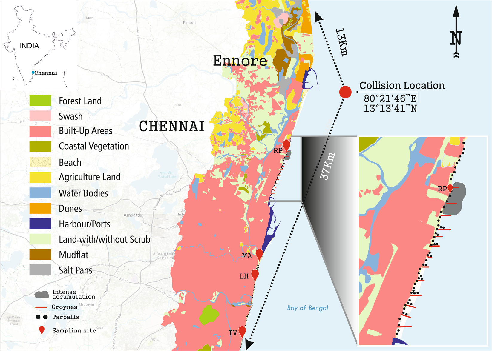
Figure 1

Location map showing ship collision site and sampling sites based on remote sensing. The samples were collected at Royapuram (RP), Marina (MA), Light House (LH) and Thiruvanmiyur (TV). Enlarged view represents intense accumulation of spilled oil contained in boom (at RP) and spread of tarballs towards south of Chennai coast. Arc GIS (version 10.5.1, http://desktop.arcgis.com/en/arcmap/) was used for creating the map.
