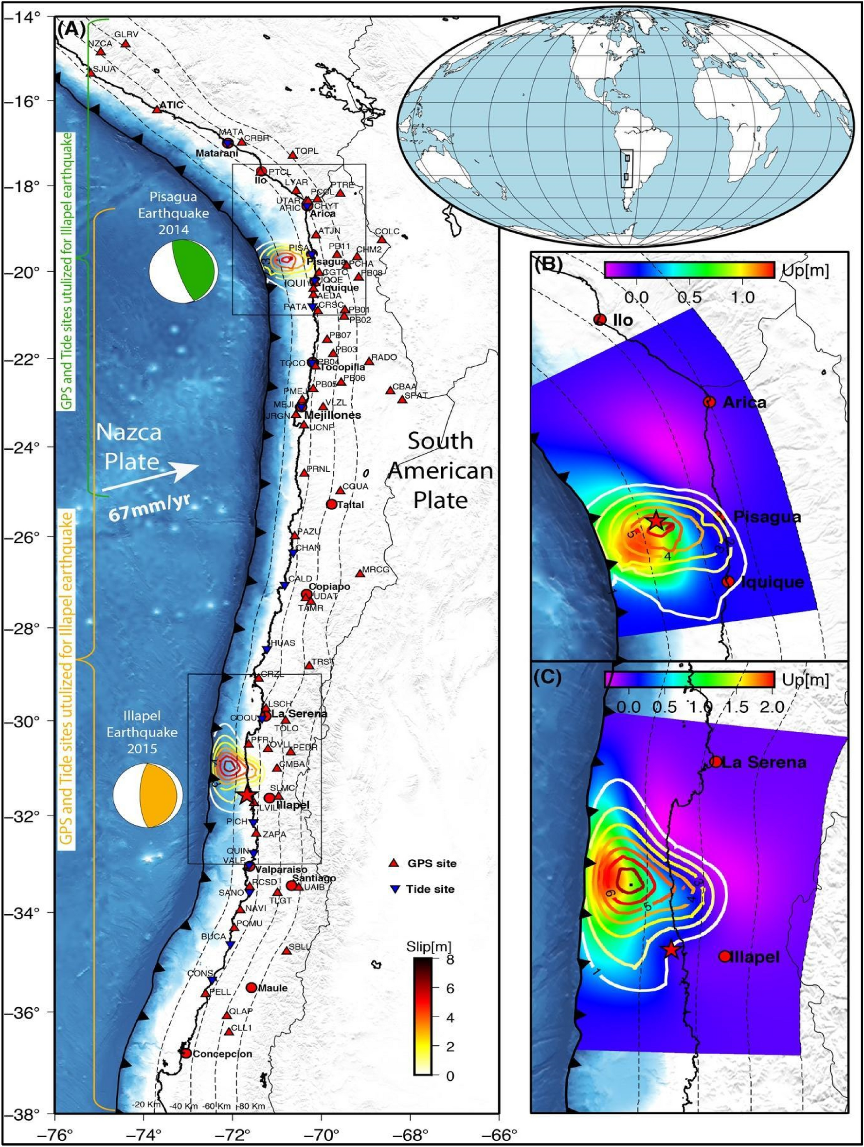
Figure 1
From: Tsunami detection by GPS-derived ionospheric total electron content

Chilean subduction zone and its tectonic setting. (A) The Chilean subduction zone experienced the 2014 Pisagua and the 2015 Illapel earthquakes. The focal mechanism solution of these earthquakes is shown in circles (green for the Pisagua earthquake and orange for the Illapel earthquake). The red triangles show the locations of GPS sites. The blue inverse triangles demonstrate the tide-gauge locations. The coseismic slip is demonstrated with the contour lines. The red stars indicate the earthquake epicenters. The rectangular region represents the area of the vertical deformation study. (B,C) The coseismic slip and vertical deformation produced by the Pisagua and Illapel earthquakes.
