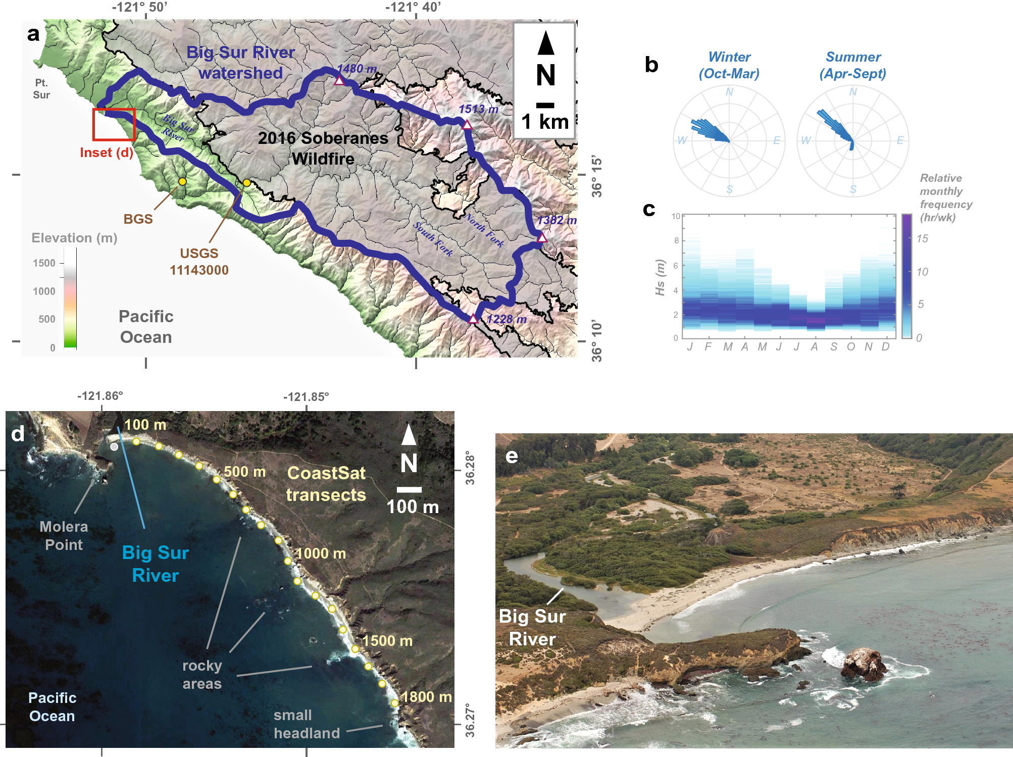
Figure 1
From: Fire (plus) flood (equals) beach: coastal response to an exceptional river sediment discharge event

Location and background information of the Big Sur, California study area. (a) Watershed map of the Big Sur River watershed, including the boundaries of the 2016 Soberanes wildfire and sampling stations. Map was created in Global Mapper version 21.1.0 (https://www.bluemarblegeo.com/) with data from the USGS 3D Elevation Program, USGS National Watershed Boundary Dataset, USGS National Hydrography Dataset, and the California Department of Forestry and Fire Protection's Fire and Resource Assessment Program (FRAP). (b,c) Offshore wave climatology from the offshore Cape San Martin buoy (Station 46028; 35.770° N 121.903° W). (d) Inset map of the Big Sur River mouth and littoral cell study area, including the eighteen CoastSat transects monitored for this study. Map was created from Google Earth Pro version 7.3.4.8248 imagery and data (https://www.google.com/earth/versions/) and assembled in Abobe Illustrator version 26.0.2. (e) An oblique aerial photo of the Big Sur River mouth and approximately 500 m of the study area beach from Sept. 11th, 2015, when the study area beach was relatively narrow compared to historical conditions (photo credit: Kenneth and Gabrielle Adelman, California Coastal Records Project, www.Californiacoastline.org).
