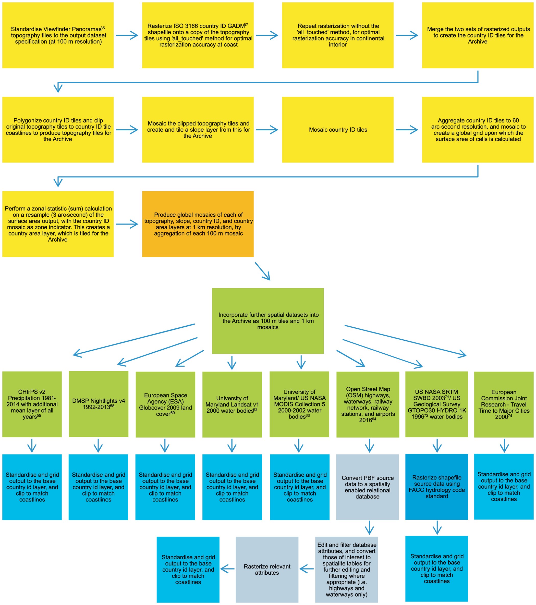
Figure 1: Schematic overview of the workflow used to produce the WorldPop Archive as 100 m tiles and 1 km global mosaics.
From: High resolution global gridded data for use in population studies

The preparation of the 100 m base grids (topography, slope, country ID, and country area) is here described (yellow panels), and the methodology for preparing the accompanying 1 km mosaics defined (orange panel). Further data layers, subsequently incorporated into the archive, are summarised (in green); and the methodological approach outlined (blue). For detailed workflow and description of base datasets and further layers please see the Methods section.
