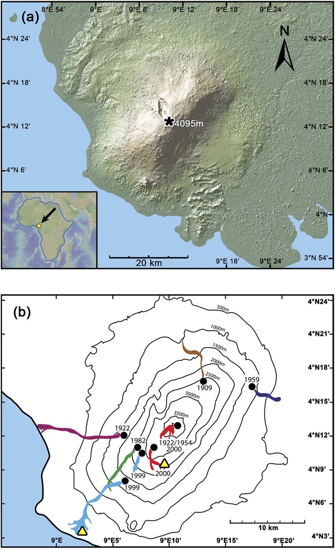
Figure 1: Location maps of Mt. Cameroon volcano and recent lava flows.
From: Locating the depth of magma supply for volcanic eruptions, insights from Mt. Cameroon

(a) Digital elevation map of Mt. Cameroon volcano, West Africa (Source: GeoMapApp, http://www.geomapapp.org)48. The volcano’s summit is indicated by a black star. (b) Topographic map of Mt. Cameroon volcano with the lava flows of the last century highlighted in colour (after Suh et al.)8. Black dots mark the vents from which the lava flows were emitted. Sampling locations are marked by yellow triangles.
