
Fig. 1: A simplified geological map and stratigraphic column of Salisbury Plain, England.
From: Detrital zircon–apatite fingerprinting challenges glacial transport of Stonehenge’s megaliths
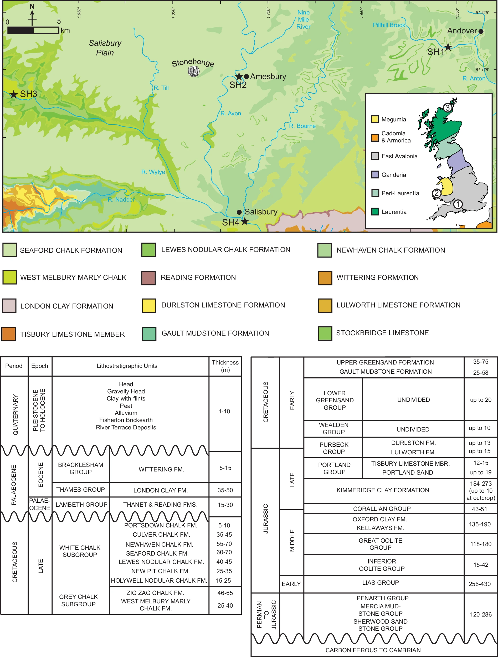
Black stars indicate the location of stream sand sample sites. Coordinates are in decimal degrees. Stream sediment sampling sites (SH1–SH4) are located within the Avon–Test drainage system catchments, as illustrated by the regional hydrology shown by blue lines. The inset shows the major basement terranes of Britain and northern France96. Circled numbers show key locations discussed, including: 1. Stonehenge, 2. Mynydd Preseli and 3. the Orcadian Basin of northeast mainland Scotland. The geodetic system used is WGS 84.
